




Neuigkeiten Timeline
Digitale Immobilienplattform erweitert Analyseangebot
NOVARION und TAROX vereinbaren strategische Partnerschaft für IT-Infrastruktur und Agentic AI
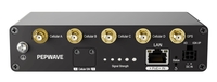
Robustes 5G für bestehende Netzwerke: Vitel erweitert Sortiment um den neuen 5G Adapter von Peplink
KI-Kompetenzen in Unternehmen: Höhere Gehälter, aber auch längere Besetzungszeiten
Sagepath Reply im Gartner® „Market Guide for Strategic Website Agencies“ 2026 gelistet
FIX&FLIP Foundation Online-Seminar mit Oliver Fischer: Praxis-Einstieg in den Immobilienhandel
Offene Immobilienfonds in der Krise – Ihre Rechte als Anleger
GAF AG and partners contracted to map European Riparian Zones
(Mynewsdesk) Munich, September 16th 2014
A European consortium headed by GAF AG has been contracted by the European Environment Agency (EEA) to implement the latest element of the Copernicus Land Monitoring Service’s Local Component: the Riparian Zones Project. The project team mainly consists of four experienced European service providers: GAF AG (Germany), INDRA (Spain), Metria (Sweden) and GeoVille (Austria). The consortium has signed a 3.7 million € framework service contract with the EEA and conducted a successful project kick-off in Copenhagen in July 2014.
As part of the Copernicus Initial Operations, the consortium will provide mapping, modelling and consultancy services to EEA in order to provide a consistent and very-high resolution delineation and characterisation of the riparian zones of major and medium-sized rivers for most of Europe and Turkey (i.e. the 39 EEA member and cooperating countries) for the first time ever. Based on optical 2.5m spatial resolution satellite imagery, the consortium will produce three separate riparian data layers by mid-2015:
* very-high-resolution land cover/land use mapping within a riparian buffer zone;
* fine-scale spatial delineation of riparian zones based on a GIS modelling approach, incorporating various geo-information layers and the latest scientific research;
* and delineation of small green linear elements as part of the European green infrastructure.
Additionally, the consortium will provide consultancy services to EEA in relation to these three data layers.
By focusing on riparian zones, which are among the most sensitive ecosystem and biodiversity hotspots in Europe, the project will enable a systematic assessment of freshwater ecosystems and riverine habitats. It will serve as a complement to the pan-European Land component (CORINE Land Cover (CLC) and High-Resolution Layers (HRL) on land cover characteristics) and to the other Local Component project, i.e. the Urban Atlas. Among other things, it will also provide support to the EU Biodiversity Strategy to 2020 and the related Mapping and Assessment of Ecosystems and their Services (MAES) as well as the associated green infrastructure and restoration objectives, the Habitats and Birds Directives, the Water Framework Directive and the European Floods Directive.
In this project, GAF AG is responsible for the overall project management as well as for creating the very-high resolution land cover / land use product for Central Europe and the British Isles. Additionally, the company will be implementing the Riparian Zones Delineation for all EEA-39 countries and be responsible for consultancy coordination and overall quality management.
————————–
Diese Pressemitteilung (http://www.mynewsdesk.com/de/aigner-marketing/pressreleases/gaf-ag-and-partners-contracted-to-map-european-riparian-zones-1055576) wurde via Mynewsdesk versendet. Weitere Informationen finden Sie im Aigner Marketing & Communications (http://www.mynewsdesk.com/de/aigner-marketing) .
Shortlink zu dieser Pressemitteilung:
http://shortpr.com/dwfah4
Permanentlink zu dieser Pressemitteilung:
http://www.themenportal.de/wirtschaft/gaf-ag-and-partners-contracted-to-map-european-riparian-zones-85245
About GAF AG
GAF AG is an e-Geos/Telespazio company based in Munich, Germany. It is a leading solutions provider with an international reputation as a skilled and reliable supplier of data, products and services in the fields of geo-information, satellite remote sensing, spatial IT and consulting for private and public clients. GAF is one of the most experienced European service providers in the EU/ESA Copernicus Programme and covers all thematic domains: Land, Marine, Atmosphere, Emergency Management and Security. GAF also provides solutions in the sectors of natural resources management, water and environment, renewable resources, mining and geology as well as security. Over the past 28 years, GAF has been active in more than 100 countries throughout Europe, Africa, South America and Asia. Further information is available at http://www.gaf.de: http://www.gaf.de/.
Pihoto: The Riparian Zones project team at the kick-off: EEA, GAF, GeoVille and INDRA
Credits: GAF
About EEA
The European Environment Agency (EEA) is a European Union public body seated in Copenhagen, Denmark. It supports the European Union in the development and implementation of environmental policy by providing relevant, reliable, targeted and timely information on the state of the environment and future prospects, as well as independent scientific knowledge and technical support. The European Commissions Directorate General for Enterprise and Industry entrusted EEA with coordinating the implementation of the Copernicus Land services continental (pan-European) and local components, as well as the service cross-cutting in situ coordination. Currently, the EEA has 33 member countries (the 28 Member States of the European Union, Iceland, Liechtenstein, Norway, Switzerland and Turkey) and 6 cooperating countries. Further information is available at http://www.eea.europa.eu: http://www.eea.europa.eu/.
About Copernicus Land Monitoring
Copernicus, previously known as GMES (Global Monitoring for Environment and Security), is the European Programme for establishing a European capacity for Earth Observation. The objective of its Land Monitoring service is to provide users in the field of environment and other terrestrial applications with consistent and up-to-date information based on space data and other sources. It addresses a wide range of policies such as environment, regional development, agriculture, transport and energy at EU level, as well as European commitments to International Conventions. It consists of three main components: global, continental (pan-European), and local. Further information on the Copernicus Programme is available at http://www.copernicus.eu: http://www.copernicus.eu/. Information on the Copernicus Land Monitoring service can be found at http://land.copernicus.eu: http://land.copernicus.eu/.
To obtain more information, please contact:
GAF AG
Daniela Miller
Arnulfstr.199, 80634 Munich
Tel. +49 (0) 89 12 15 28 0
Fax. +49 (0) 89 12 15 28 79
info@gaf.de: mailto:info@gaf.de
www.gaf.de: http://www.gaf.de/
Kontakt
–
Birgit Aigner
Erika-Mann-Str. 56
80636 München
089 543 44 065
info@aigner-marketing.de
http://shortpr.com/dwfah4
Anzeige